
Palabras clave
arqueología visual
investigación abierta
cultura material
isla
archipiélago
San Andrés
Descriptores
Isla de San Andrés (Colombia)-Mapas
vida cotidiana-Aspectos socioculturales-Isla de San Andrés (Colombia)
participación comunitaria
Cómo citar

Resumen
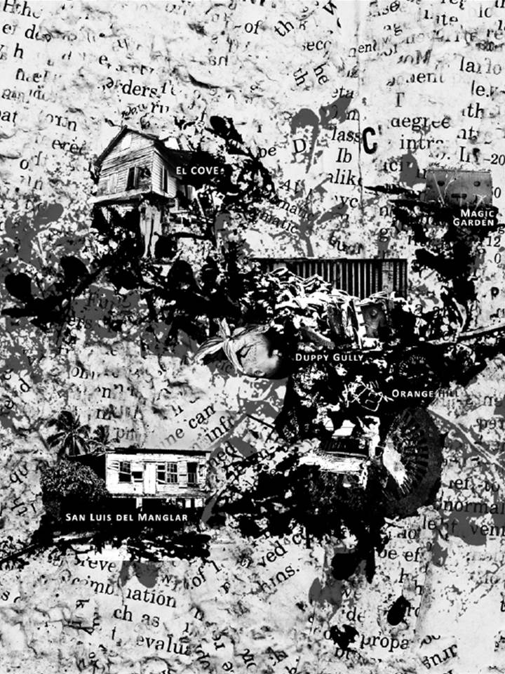
Elaboramos una cartografía que cuestiona los mapas del Archipiélago de San Andrés, Providencia y Santa Catalinaque simplifican su imagen al representarlo como islas aisladas y vacías. Utilizamos la arqueología visual como metodologíade excavación en fotografías de objetos abandonados para trazar una carta gráfica de la isla de San Andrés.Esta perspectiva nos permite dar cuenta del andar en el paisaje e integrar aquello que habita en lo cotidiano de lasislas. Concluimos con la reflexión acerca del papel de la investigación abierta como una manera de establecer puentespara la comunicación y apropiación del conocimiento de forma conjunta.La revista Apuntes se encuentra registrada bajo la licencia Creative Commons Reconocimiento 4.0 Internacional. Por lo tanto, esta obra se puede reproducir, distribuir y comunicar públicamente en formato digital, siempre que se reconozca el nombre de los autores y a la Pontificia Universidad Javeriana. Se permite citar, adaptar, transformar, autoarchivar, republicar y crear a partir del material, para cualquier finalidad (incluso comercial), siempre que se reconozca adecuadamente la autoría, se proporcione un enlace a la obra original y se indique si se han realizado cambios. La Pontificia Universidad Javeriana no retiene los derechos sobre las obras publicadas y los contenidos son responsabilidad exclusiva de los autores, quienes conservan sus derechos morales, intelectuales, de privacidad y publicidad.
El aval sobre la intervención de la obra (revisión, corrección de estilo, traducción, diagramación) y su posterior divulgación se otorga mediante una licencia de uso y no a través de una cesión de derechos, lo que representa que la revista y la Pontificia Universidad Javeriana se eximen de cualquier responsabilidad que se pueda derivar de una mala práctica ética por parte de los autores. En consecuencia de la protección brindada por la licencia de uso, la revista no se encuentra en la obligación de publicar retractaciones o modificar la información ya publicada, a no ser que la errata surja del proceso de gestión editorial. La publicación de contenidos en esta revista no representa regalías para los contribuyentes.